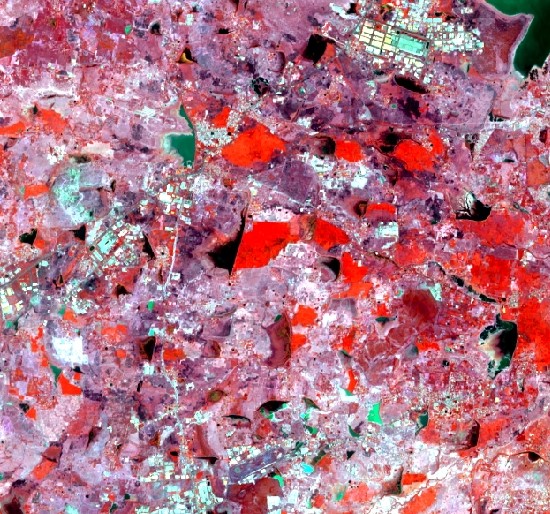
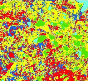
Image Classification techniques are used to categorize the pixels in the satellite data for differentiating the various earth features such as barren land, forests, roads, settlements, water bodies, rocks based on the spectral reflectance. This technique is highly used to generate the LULC (Land Use Land Cover Map).
Here the types of Image classifications techniques are explained. I’ve used Arc GIS, QGis, Erdas, Arc Map for image processing for sample images used below.
There are three techniques to classify the image.
- Supervised Classification
- Unsupervised classification
- Object-based or object-oriented classification
1. Supervised Classification
Supervised Classification is a more accurate and widely used type. To run this classification you have to collect the data to choose the land cover classes (training sites) by a visual digitizing method with the help of the user. Ensure the software you are using is accurately classifying the full satellite data.
The Traning site location data will be collected in high-resolution imagery. This is considered as a representative of a certain land cover types. You have to make a choice depending on the area covered in a full range of variability within the class.
The software will allow classifying the image accurately. However, the machine determines the spectral signature of the pixels within the training area to find a close match. The information is defined with the help of statistics which includes the mean and variance of each class to relate with all the inputs.
But the classification will be less accurate if the training areas are not representative of the range of variability found within a particular land cover type. You can select multiple small training sites for each class. You have select and collect the training site data with optimal effort to drive better classification results.
The most common classification algorithms used for supervised classification are Minimum-Distance to the Mean Classifier, Parallelepiped Classifier, Gaussian Maximum Likelihood Classifier, Mahalanobis Distance, Spectral Angle Mapper, Neural net, BinaryEncoding, spectral Angle Mapper, Hybrid classification, Fuzzy Set Classification.
2. Unsupervised Classification
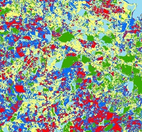
Unsupervised Classification another type that is used to classify the satellite data. It is the computer-automated classification technique that is lightly similar to object-based image classification. It consists of two algorithms K-means and Iso cluster. You have chosen the number of classes and pixels that grouped based on their spectral value.
The Iso clustering algorithm is helpful when it comes to iterative optimization to separate cells into the user-specified number of particular classes. At the start of the process, the software automatically assigns arbitrary mean to cluster defined by the users.
During each iteration, samples are assigned based on the attribute distances between the cells which belong in the cluster. This process is repeated after each iteration and each pixel is assigned to the closest mean in the attribute space.
The utility of an unsupervised classification algorithm is to map the satellite data for various purposes such as land use and land cover and many other purposes.
Also Read
How to Geocode and Reverse Geocode Addresses using QGIS
3. Object-Based/ Object-Oriented Classification
Both spectral and spatial information uses for Object-based classification and Object-based classification methods were developed recently compared to traditional pixel-based classification techniques.
The pixels are categorized based on their spectral, shape, spatial relationship with the closest pixels, texture and, characteristics. This technique is based on similar objects. The object-based classification can be done through two steps, first, the image is segmented or broken into discrete objects features with and each object is classified.
Segmentation
The process where the pixels in an image are grouped into segments. Image segmentation is the most important step and real-world feature in object-oriented classification techniques. The segment can feature similar to spatial and spectral characteristics and every feature includes multiple pixels.
There are various parameters to consider in segmentation such as scaling the features and variables in the image segmentation process. The less number of pixels is defined as a separate segment.
Once the image is segmented with appropriate image objects, The classification is based on the assigned object and criteria according to the desire of the user. The criteria as divided into two groups, Characterertices related to each object and relationship between objects. For instance, roads can be more elongated, Buildings can be in different shapes as such. To improve the classification of the roads the connectivity of the features is identified depending on the criteria.
Object-based classification methods perform excellent with white and black or multispectral imagery that is high resolution. You can also use it on low-resolution imagery as well. This technique is a quick and automated method for identifying and extracting features that might consume more time for an analyst.
Have any doubts? Feel free to comment on it below section. We will get back to you.
Interested in getting regular updates on technologies and development? Subscribe for the exclusive weekly for noteworthy updates. Need GIS solutions for your business? Get started by hiring the right experts for your project at Agira Technologies.