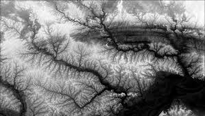
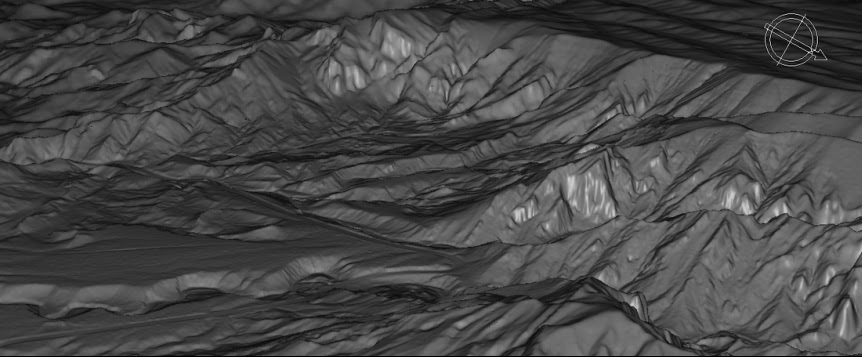
A DEM or digital elevation model is a 3D CG representation of a terrain surface. It is an array of regularly spaced values that are referenced horizontally to a geographic coordinate system. We can explore and analyze the earth in three different dimensions. There are numerous DEM data, However, finding one to use can be confusing. So, now, out of my brief search on free DEM data, I found some to analyze and use the Data sources which I found interesting on the internet. Le me shares those 5 free global DEM data sources through this blog.
1. Shuttle Radar Topography Mission (SRTM)
The SRTM or Shuttle Radar Topography Mission is an international research effort that obtained digital elevation models to generate the most complete high-resolution digital topographic database of Earth. The Non-Void Filled data in the outer regions of the US were sampled at 3 arc seconds which is approximately 90 meters. It uses a cubic convolution resampling technique for the resolution and open distribution.
The Void filled data of SRTM is 3 arcsecond for the actual region in the united states with 3 src seconds for global coverage. The overall evaluation data of worldwide coverage of void filled data at a resolution of 1 arc-second (30 meters) and provide open distribution of this high-resolution global data set.
To download, SRTM Dem in USGS Earth Explorer select your area of interest. Under the data sets tab, select Digital Elevation > SRTM > SRTM 1-ArcSecond Global .
2. Advanced Spaceborne Thermal Emission and Reflection Radiometer (ASTER)
The Global Digital Elevation Model (GDEM) was released on June 29, 2009. It is a joint operation between NASA and the Ministry of Economy, trade, and industry (METI)of Japan. This data source has a complete mapping of the earth. It covers almost 99% of the earth’s surface.
NASA’s Shuttle Radar Topography Mission is another most comprehensive map which approximately covers 80% of the earth’s surface with a global resolution of 90 meters and 30 meters over the US. The GDEM version 2 was released in October of 2011 to the public. This version has added improvements to data accuracy and resolution for more realistic values.
To download ASTER DEM, you’ll have to register online through the Earth DATA and select your location spatially and search the Datasets you want.
Also Read: 30 Best Satellite Maps To See Earth in New Ways
3. JAXA’s Global ALOS 3D World
This data set is a global digital surface model (DSM) with a horizontal resolution of approximately 30 meters (1 arcsecond) by the Panchromatic Remote-sensing Instrument for Stereo Mapping (PRISM) onboard the Advanced Land Observing Satellite “ALOS”.
In May 2015, “ALOS World 3D-30m (AW3D30)”, a free 30 meters resolution version of “ALOS World 3D (AW3D)”, was released. An area of no-data or low-quality, from 60 degrees north to 60 degrees south, was filled in with version 1.1 released in March 2017 and 2.1 released in April 2018.
To download ALOS DEM , you’ll have to register online through the JAXA Global ALOS portal to download it.
4. GTOPO30
GTOPO30 is a global digital elevation model (DEM) with a horizontal grid spacing of 30 arc seconds. GTOPO30 was derived from several rasters and vector sources of topographic information. For easier distribution, GTOPO30 has been divided into tiles which can be selected from the map shown above. Detailed information on the characteristics of GTOPO30 including the data distribution format.
GTOPO30, completed in late 1996, was developed over a three year period through a collaborative effort led by staff at the U.S. Geological Survey‘s Center for Earth Resources Observation and Science (EROS).
To download, GTOPO30 Dem in USGS Earth Explorer select your area of interest. Under the data sets tab, select Digital Elevation > GTOPO30
5. Global Multi-resolution Terrain Elevation Data (GMTED2010)
The USGS and the National Geospatial-Intelligence Agency (NGA) have collaborated on the development of a notably enhanced global elevation model called the Global Multi-resolution Terrain Elevation Data (GMTED2010), which has replaced GTOPO30 as the elevation dataset of choice for global and continental scale applications.
Since the time GTOPO30 was completed, the availability of higher-quality elevation data over large geographic areas has improved markedly. New data sources include global Digital Terrain Elevation Data (DTED) from the Shuttle Radar Topography Mission (SRTM), Canadian elevation data, Spot 5 Reference 3D data, and data from the Ice, Cloud, and land Elevation Satellite (ICESat). GMTED2010 provides a new level of detail in global topographic data.
To download, GMTED2010 DEM in USGS Earth Explorer select your area of interest. Under the data sets tab, select Digital Elevation > GMTED2010
Conclusion
You can use these open source DEM for various 3D analysis & Visualisation purposes like in Flood Modelling, Urban development, Transportation planning, etc. But open source DEM has minimal resolution data when comparing Lidar data.
Feel free to share your recommendations and doubts below in the comment section. We are excited to hear from your side!
Need something more? Subscribe for our newsletter to receive our content value on Geographical Information systems and related technologies.